Hyperspectral imaging provides a powerful, non-destructive method for analyzing mineral composition across wide areas, both in the field and in the lab. It captures unique spectral signatures enabling accurate mineral differentiation, detection of hydrothermal alterations, and evaluation of ore potential with unmatched precision.
From airborne surveys to core sample analysis, hyperspectral imaging is the ideal tool for accurate and efficient geological mapping, mineral identification, and mining operations.
Accurate Mineral Identification: Distinguish and map minerals based on their unique spectral signatures, enabling precise identification of alteration minerals associated with oil, gas, and ore deposits.
Improved Exploration Targeting: Detect surface geochemical indicators and alteration zones that guide geologists to high-potential exploration targets, reducing uncertainty in early-stage exploration.
Non-Destructive Analysis: Analyze geological formations without disturbing the environment, supporting sustainable exploration practices and regulatory compliance.
Enhanced Geological Mapping: Generate detailed mineralogical and lithological maps that improve understanding of subsurface structures and depositional environments.
Early Risk Reduction: Identify unfavorable zones early in the exploration process, allowing teams to focus resources on the most promising prospects.
Remote and Hazardous Area Access: Enable exploration in regions that are difficult, dangerous, or costly to access on the ground, improving safety and operational efficiency.
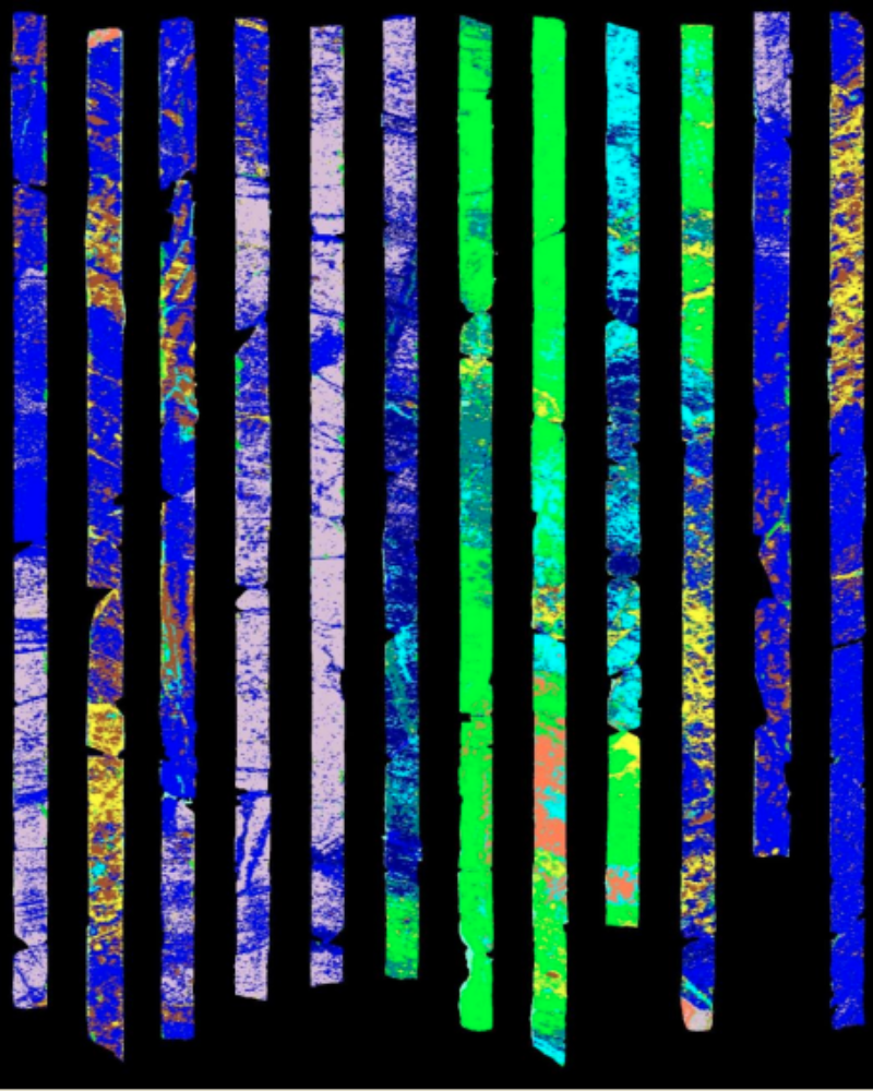
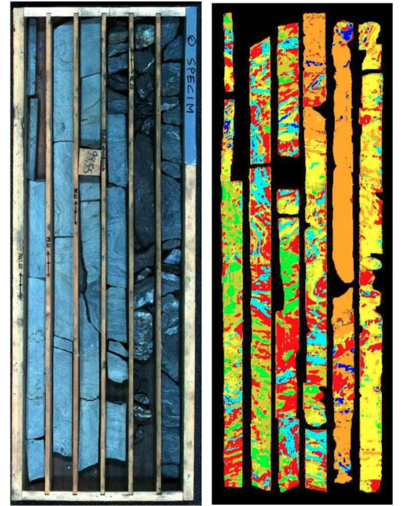
MineralExploration&CoreLogging
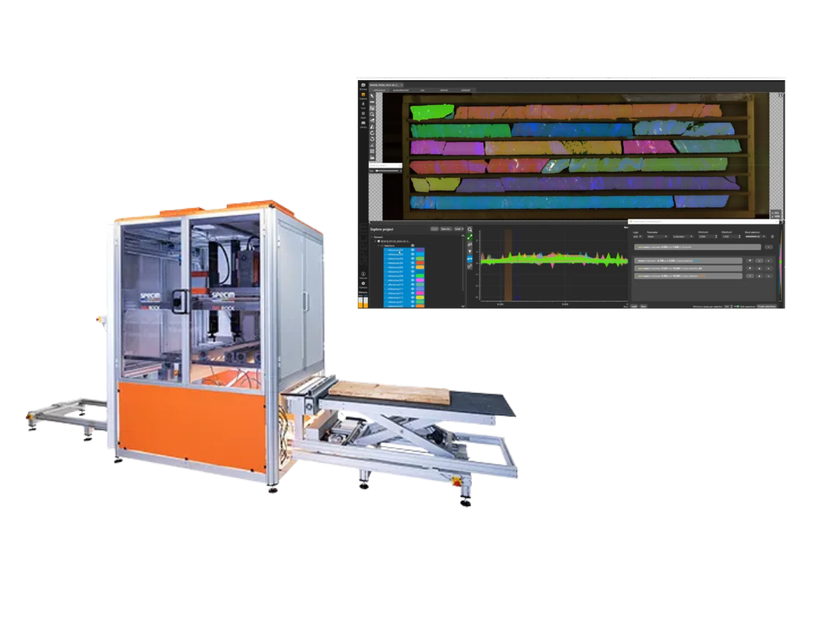
Airborne hyperspectral imaging is an established and proven method for effective mineral exploration. It is also frequently used for rapid and reliable mineral analysis for drill core and other geological samples.
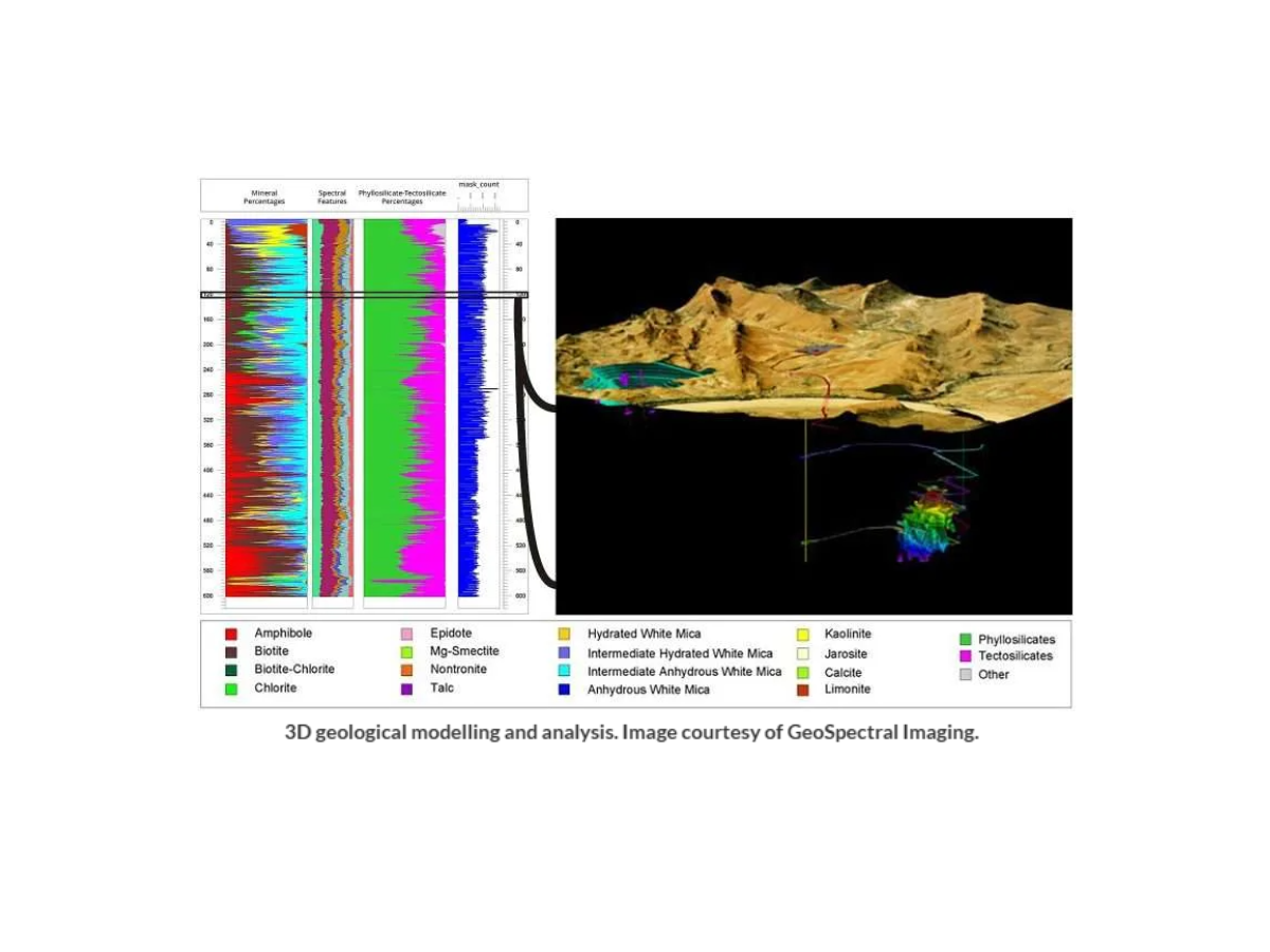
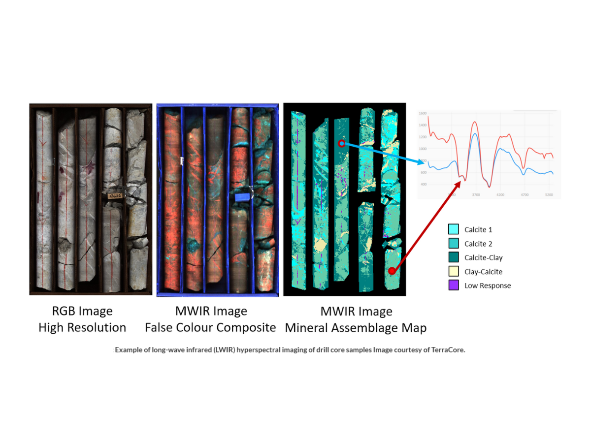
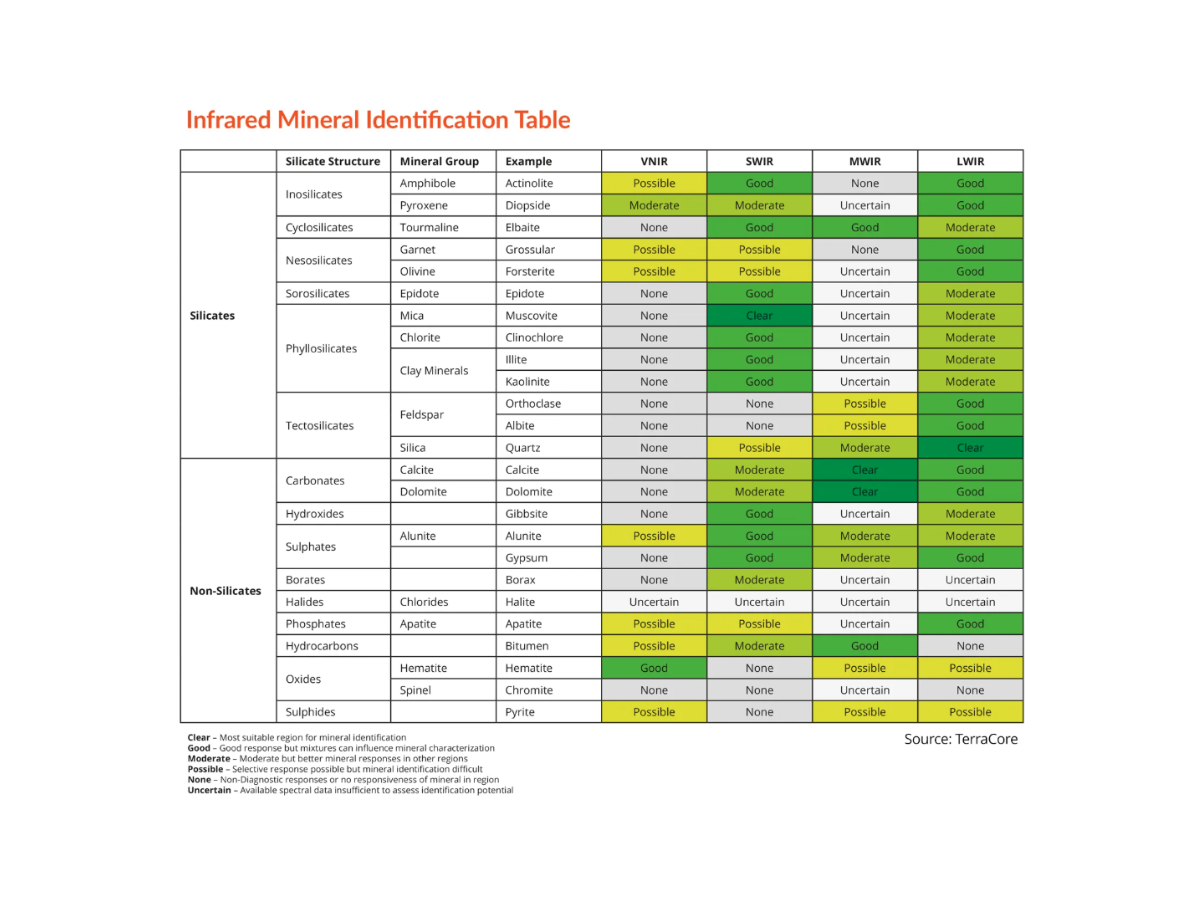
Hyperspectral imaging in the infrared region reveals alteration patterns that cannot be detected through traditional visible logging methods, and offers objective and consistent identification and mapping.
The Specim SisuROCK workstation has become a market-leading tool for analytical service providers, national geological surveys, and mining companies to rapidly image entire core boxes and process large volumes of core quickly and efficiently.
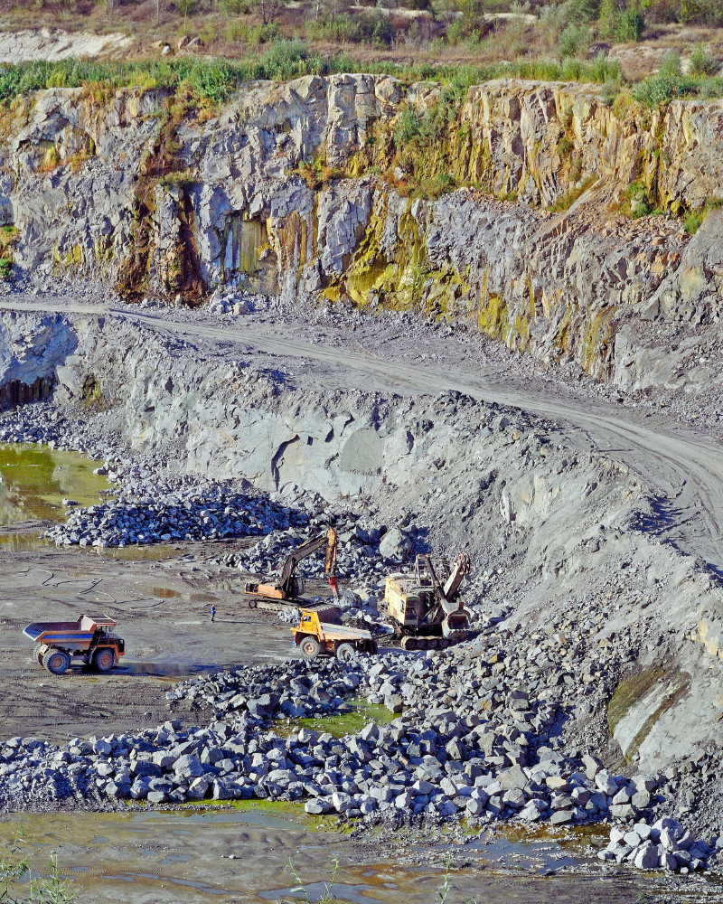
Mining&Proccessing
Hyperspectral cameras are increasingly popular not only for efficient core logging, but also at mining sites and on processing lines, and can be used to image entire mine wall faces on ground vehicles or drones for rapid mineralogical mapping.
Hyperspectral imaging allows for mapping of clays, talc and other deleterious rock phases, producing valuable information for building predictive models of mining and geometallurgical parameters.
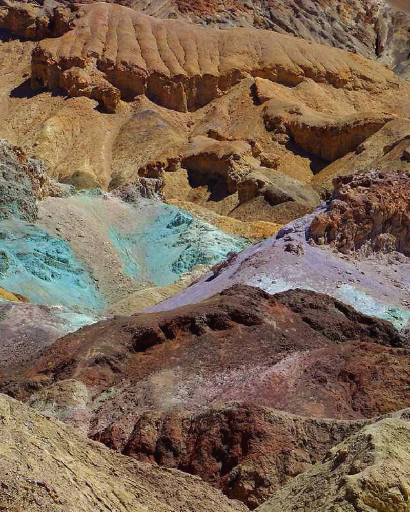
IronOxideMineralsandRareEarthElements
Iron oxide minerals are essential in mineral exploration as they are often the only visible clues to underlying mineral deposits. Iron oxide minerals have a characteristic spectral feature in the 800-1000nm wavelength range, allowing them to be accurately detected by UAV optimized systems such as the Specim AFX10 and AFX17.
Iron oxide concentrations are associated with specific types of 'host rocks', which are sometimes indicative of potential ore deposits. Hyperspectral imaging can be used to classify iron oxide concentrations based on host rock substrates, increasing the potential to identify rock outcrops most likely associated with ore deposits.
Rare Earth Elements (REEs) are a group of metallic elements that are indispensable for the manufacturing of high-technology products, including consumer electronics. These elements occur in particular minerals and can be identified with hyperspectral imaging technology due to their key spectral features in the VNIR wavelength range. This makes hyperspectral remote sensing a ground-breaking tool for the exploration of economic concentrations of REE-bearing minerals.